Alex Tena
Product Manager
at CARTO
Product Manager
at CARTO
Watch this hands-on webinar for practical tips on how CARTO can simplify your spatial app development cycle.
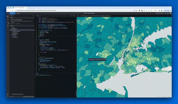
Alex Tena (Product Manager at CARTO), will walk you through the full suite of developer tools we have available across our cloud native spatial analytics platform.
Using practical examples, Alex will guide you through the steps developers can follow to seamlessly build truly scalable spatial applications.
This session covers:
• How the latest release of deck.gl consolidates a future-proof architecture, using CARTO and the latest GPU technologies to visualize vector and raster data directly from your cloud data warehouse with no ETLs required.
• A quick review of CARTO Builder, where developers can prototype maps; and CARTO Workflows, where developers can visually build analytical pipelines that can be scheduled or executed via API.
• An introduction to the new Boundaries data source (currently in Beta) to aggregate data into common or custom boundaries such as postal codes to achieve unparalleled performance in your application with little effort and data preparation.
Check out the slides here.