Margara Tejera
Product Manager at CARTO

Miguel Álvarez García
Lead Data Scientist at CARTO
Product Manager at CARTO
Lead Data Scientist at CARTO
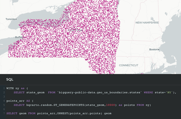
CARTO brings advanced spatial analytics natively to BigQuery. Using our Analytics Toolbox, Analysts and Data Scientists can unlock more than 100 spatial functions in BigQuery to enhance data, run advanced spatial analysis and apply industry-specific models to drive business decisioning.
Join Margara Tejera (Product Manager at CARTO) and Miguel Álvarez García (Lead Data Scientist at CARTO) in this practical webinar, where they showcase some of the key functions of the Analytics Toolbox and how CARTO users can utilize spatial indexes, advanced analysis functions and map visualizations to analyze massive datasets, natively in the cloud.
What we cover in the session: