
Argyrios Kyrgiazos
Data Scientist at CARTO
.jpg)
Antonis Tofarides
Product Manager at CARTO
Data Scientist at CARTO
Product Manager at CARTO
As retailers realign their property footprint, supply operations and marketing efforts to respond to changing consumer behaviors, there is an ever-growing need for relevant data and analytics to tackle retail's most important big data challenges.
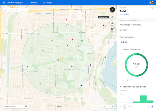
CARTO for Retail brings together data, spatial visualization, apps and powerful analysis functions for retail site selection and planning.
In this practical webinar, Antonis Tofarides (Product Manager at CARTO) and Argyrios Kyrgiazos (Data Scientist at CARTO) outline the key components of this new cloud native Location Intelligence platform for retailers. The webinar focus on some of the key functions from our Analytics Toolbox, using practical site expansion examples.
What we cover in the session:
A PDF of the slides of the presentation is also available to download here.